Well, write on.
Through requests and an over inflated ego, I'm starting this; http://techhouseontheprairie.blogspot.ca/
A record of my trials and tribulations trying to adapt to a country of friendly, polite weirdos (and I mean that in the nicest possible way).
I guess.
Friday, 31 August 2012
Saturday, 18 August 2012

Thursday, 16 August 2012
Tuesday, 14 August 2012
Bearly made it.
Yes. that's right. More bear puns!
What I am referring to is the 45 to 50ish km bike ride I had planned at the weekend. Looked pretty good on the map. Basically a loop from the field centre going through two passes. It's more distance than I would normally consider, having only been out properly on my bike maybe 8 times in the past 2 years, but it's hard to find loops out here. Too much out and back on the same trail. Seems like a waste to me. So 50km for a nice 5ish hour ride, seemed pretty good. My reading of the map said it was reasonably flat, so the legs could probably handle it. Besides, 50km was probably an overestimate.
The route was; leave from the front door, go over the dam at barrier lake, head south along Stoney trail then cut up west up the Jewel pass trail. Continue northwest along the Quiate Valley trail, and follow that until it heads west again along the bow valley. Quaite Valley trail then meets the Bow Valley Trail which dumps you out at the bottom of a road which goes up to Skogan Pass trail. After following the Skogan Pass trail going east, it eventually meets the Stoney Trail near Kananaskis village. Then it's just a matter of following Stoney trail back to Barrier lake and then back over the dam to the front door. Easy.
So I got started just after 10am. Stoney trail and Jewell pass were fine. I've been along both before, so knew what to expect. Jewell downhill is much more fun than uphill! Still it wasn't too bad. And my new (finally) back tyre seems to have made a big difference to my ascending ability. I took it easy up here because I knew I'd need to save something for later on. At the top of Jewell pass, I went onto the Quaite Valley trail. I had expected this to keep climbing. It didn't. It went down rather steeply! Not a problem you might think, and at the immediate time you'd be right. It was a wide trail, and pretty easy to keep up some good speed. But for every metre I went down, I knew that at some point I was going to have to climb
back up. So this went down around 300 vertical metres. Which is more than I'd climbed at the other side. So this meant two things to me. One, I knew there was going to have to be a reasonably sustained climb later, and; two, that there was no way in hell I was turning back on this ride because going back up what I had just come down would be horrific.
Following the Quaite Valley trail along to the west would soon test my resolve for not climbing back the way I came. It's quite a nice piece of singletrack with some flowing rolling gradual downhill. So I was getting along quite nicely, keeping up a reasonable pace. That was until I rounded one particular bend and saw a black bear approximately 20m along the trail! Luckily I think it was as surprised as me and it ran off into the trees. Now, this was my first encounter with a bear without the safety of a vehicle. So I wasn't sure what to do. I remembered that you have to identify yourself as human by talking loudly. So I sang made up bear songs (feeling rather ridiculous, but probably better than getting eaten) while I ran the
options through my head. There were only really two. Go back the way I came and up that horrible climb. Or pedal very fast for the next few kilometres and hope the bear didn't feel like chasing me. After a change of underwear, I opted for option 2. I was only 14km into the ride by then, so I didn't really want to stop early. So, with more singing and quick legs I continued down the trail. No sign of the bear again. Phew.
Onwards it was. With just a quick pause at Heart Mountain car park (where the Quaite valley trail meets the Bow valley trail) to ruin peoples planned walks by warning them about the bear, and calling in the bear sighting. I thought I'd better, the trail seemed quite popular with families. So onto Bow valley trail, which had a double
black diamond sign. This is a sign which to mountainbikers means "fun ahead, but with a high probability
of pain". I hadn't expected this. I thought it would just be a nice rolling connecting trail. And actually, I'm a bit disappointed with the difficulty level. I would have rated it red at most. There were a few dodgy bits. But the marked features weren't that tough. There was one rock slab (it was called a drop, but there was no dropping necessary), and one section with a steep drop to one side, and wooden stairs going up. Neither were too bad. Reading up later, it is apparently better to ride it in the other direction, which I can see. Still, double black diamond seems a bit of an over rating. This part of the ride passed without much incident. The only thing of note was what looked like fresh cougar kill lying on the trail. So I might have disturbed a kitty. Back to pedalling fast again, just in case. The end of the trail got me to about 22km into the ride.
From here I wasn't quite sure where to go. Unhelpfully, Jeff had buggered off with the map I needed before I left, so I was going by memory. Which is to say, my memory is crap, so I was going by smart phone. It showed me I had a bit of a climb up a road to the bottom of Skogan pass trail. Excellent I thought. the more of this climb I get done on road the better! Even if it is a loose surface road. It was a bout a 2km climb, which was slow, but steady. There was a nice picnic area at the trailhead too, so I got to stop and have some lunch and rest for a while.
By the time I got going again, it was 3 and a half hours since I started. But I was at 24km, so probably just about half way. Which was quite a nice positive thought to have when I got to the bottom of the Skogan pass climb. It was so depressing I forgot to take a photo of it. But the trail for the most part follows the electricity lines up the hill. That means you can see almost all of the route up from the bottom. And it did not look good! And it did look steep. And it did look long. And the trail sign said 14km. Oof. Well, I wanted at least one epic ride while here, so at least I was getting it. There's not much to say about the progress up the pass, except
that it was pretty slow. And that I did resort to pushing at some point. I did meet a nice couple coming down the trail, who had been up to the summit of pigeon mountain. When I told them where I was headed there was that sucking of breath through the teeth that is the last sound you want to hear! Over the pass and on to Barrier lake you say? Ooooh, you've got a good 4 hours ahead of you! Yeah, thanks buddy! I was about 4 and a half hours in by this time. I got a bit lost again as there were a few turn offs, so I was back to the smart phone. Which was very close to having a flat battery. Pulling up a trail guide I found one that told me the right route, but which also told me that the climb was rated very difficult and was 670m of elevation gain. I'm glad I didn't see that at the bottom. I may have taken my chances with the bear and going back up Quaite Valley! So it was back to climbing, after another half hour, the gradient eased a bit and I could cycle again. I got to the top of the pass at around 5 and a half hours into the ride and about 33km. It was a huge relief to finally see the mountains of the Kananaskis valley.
Downhill is always a relief, and it was a nice long descent from the top. I had to make a brief stop at a stream to refill my water supply. I had managed to go through 3 litres, which I rarely drink half of. There were also a couple of photo stops, but in general, this ride wasn't that great for pictures. It was in the trees most of the time, and I don't really like pictures with electricity pylons. Continuing the descent, again I was able to get up quite a bit of speed. Nothing challenging, wide double track all the way. I was able to admire things at the side of the trail. Like the base of that tree which has fallen over and is showing the dark soil in it's roots. I got to look at that for a good 10 seconds before it jumped out and ran over the
trail! Not roots. Another black bear! It was watching me coming and thought about it a bit before running away! It was a smaller one this time. But it was a quick decision this time to keep going. I was going fast, so I would be out of range pretty quickly!
Skogan Pass comes out somewhere in the Nakiska ski centre. Which meant lots of paths and no signs. So I lost the trail for a bit. This meant I got a bit of a rest pedaling around trying to find a sign showing me where the Stoney Trail starts. What I really wanted to know was how far along the Stoney trail it was to Barrier lake. At this point I had been on the bike for 6 and a half hours, and 42km. I
was pretty sure by now my estimate of 50km would probably not be an overestimate. I eventually found a sign, but no distance.
Stoney trail runs by the Kananaskis river, so it was a good place to stop and eat my emergency sandwich and some oreos. Perhaps too good. I didn't really want to get up again. But it was now the final push. Stoney trail is all double track as well, with rolling hills. For the most part I got along this pretty quickly. The trail is pretty rocky though, and on one of the dowhill rolls where I got some speed going, I managed to kick up a boulder which bent one of the teeth on my big gear, and put a big dent in my frame. Luckily there was no way I needed the big gear at this point! After slogging along for about an hour, I finally got to the top of Barrier lake. I was just whizzing down another hill when something black jumped back from
the side of the trail and ran off. Another black bear. This time I think it was a cub. So some definite fast pedaling in case mummy bear was around! That was the last noteworthy incident of the ride, which finished 7 hours 54 minutes and 63.6km after it started and included around 1200m of total elevation gain. So much for my 50km max, reasonably flat nice easy day ride! Utterly spent would be a good description of me at the end. However, I have to say, it was fantastic. Not something I'd want to do every week though. Maybe once a year! For anyone interested in the route, here's my GPS record of it.
What I am referring to is the 45 to 50ish km bike ride I had planned at the weekend. Looked pretty good on the map. Basically a loop from the field centre going through two passes. It's more distance than I would normally consider, having only been out properly on my bike maybe 8 times in the past 2 years, but it's hard to find loops out here. Too much out and back on the same trail. Seems like a waste to me. So 50km for a nice 5ish hour ride, seemed pretty good. My reading of the map said it was reasonably flat, so the legs could probably handle it. Besides, 50km was probably an overestimate.
 |
| Some kinda bird on the Jewell Pass |
 |
| Quaite Valley |
 |
| Quaite Valley again |
 |
| Quaite Valley trail in Bow Valley |
 |
| Bow Valley Trail |
 |
| Rock slope more like! |
 |
| "Rock drop" |
 |
| Looks harder from here, but still... |
of pain". I hadn't expected this. I thought it would just be a nice rolling connecting trail. And actually, I'm a bit disappointed with the difficulty level. I would have rated it red at most. There were a few dodgy bits. But the marked features weren't that tough. There was one rock slab (it was called a drop, but there was no dropping necessary), and one section with a steep drop to one side, and wooden stairs going up. Neither were too bad. Reading up later, it is apparently better to ride it in the other direction, which I can see. Still, double black diamond seems a bit of an over rating. This part of the ride passed without much incident. The only thing of note was what looked like fresh cougar kill lying on the trail. So I might have disturbed a kitty. Back to pedalling fast again, just in case. The end of the trail got me to about 22km into the ride.
 |
| Just before the Skogan Pass trailhead |
 |
| Mount Lougheed I think. View from lunch. |
 |
| About the only view from Skogan Pass |
 |
| Water refill station! |
 |
| The road to a bear... Wheeeeee! |
Skogan Pass comes out somewhere in the Nakiska ski centre. Which meant lots of paths and no signs. So I lost the trail for a bit. This meant I got a bit of a rest pedaling around trying to find a sign showing me where the Stoney Trail starts. What I really wanted to know was how far along the Stoney trail it was to Barrier lake. At this point I had been on the bike for 6 and a half hours, and 42km. I
 |
| Last break before Stoney. |
Stoney trail runs by the Kananaskis river, so it was a good place to stop and eat my emergency sandwich and some oreos. Perhaps too good. I didn't really want to get up again. But it was now the final push. Stoney trail is all double track as well, with rolling hills. For the most part I got along this pretty quickly. The trail is pretty rocky though, and on one of the dowhill rolls where I got some speed going, I managed to kick up a boulder which bent one of the teeth on my big gear, and put a big dent in my frame. Luckily there was no way I needed the big gear at this point! After slogging along for about an hour, I finally got to the top of Barrier lake. I was just whizzing down another hill when something black jumped back from
 |
| Bang! |
 |
| This is the longest I've ever ridden. |
Saturday, 11 August 2012
The end is nigh!
 |
| Nemesis |
It's funny thinking back to writing my proposed methods. In that, I had devised an amazing plan that
 |
| Straightish... |
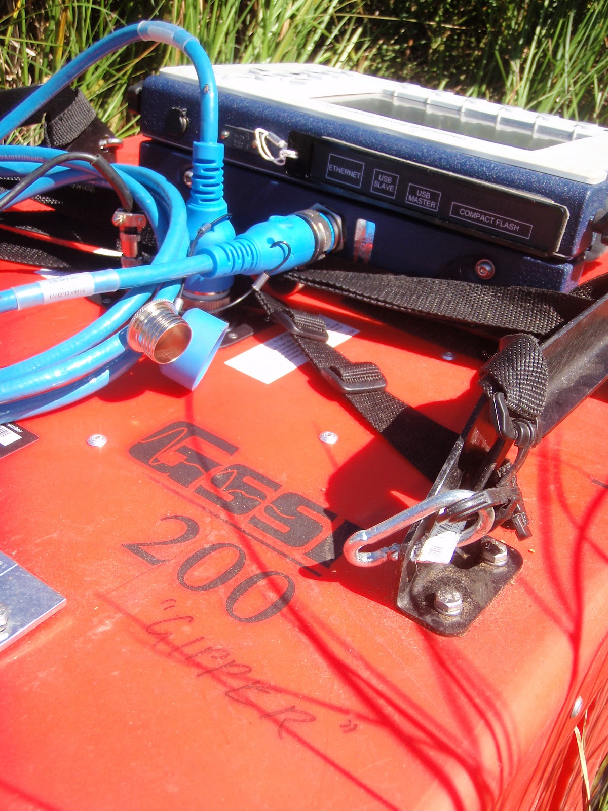 |
| Graffiti on $30k equipment... |
Probably in good time too. Working in the open air is great, but there's definitely a bit of the "too much of a good thing" going on. Plus there has been the minor frustration of work getting in the way of all the fun things out here. In theory, hiking for work every day should give you some enjoyment of hiking around in fantastic scenery, but howfing heavy kit all over the place and constantly looking at your feet to see how deep the water is kind of distracts you from that! Never mind though. With our 10 day work epic, we should have left ourselves some free time for rest and relaxation. That would be in the form of biking or hiking...
 |
| One of the more challenging sites for GPR. Need a boat. |
 |
| Toley inspection. Or is it clay? |
Sunday, 5 August 2012
Grand
Just a quickie. A wee thanks to everyone who's been reading. That's the blog been read 1000 times! I've had lots of positive comments, which is nice! Maybe I should extend my blogging into the day to day drudgery of normal life in Saskatoon. And maybe you all need to invest in some books by proper writers!
Saturday, 4 August 2012
Trail and error
I've been slacking again. Slow to update. It's because we're really getting down to some work. Or at least that's the impression I want to give the boss...
| What you have there is soil. With lines in it. |
 |
| One man... |
 |
| ...banned |
So yes, that's going well. We are also up to 83 sites now. We did attempt to get the 7 sites at the end of the Jeep eating trail. It was a squeaky bum drive out along the trail. It was much drier, but much more rutted too. So we edged along it and got 8km in in about an hour (previous record, 6km on bikes). We were still 1km away from the start point to walk to these sites though. In a fit of sense, I called it off and decided to head back. The next couple of hundred metres looked really bad. We probably could have made it, but what was really worrying me was the bank of cloud that was coming over the mountains. I could imagine all too easily is spending 2-3 hours going to these sites, then the rain starting, and the trail going to mush, and us being stranded 8km away from the road. So those sites were binned. Aggravating. We did have a lead on getting access to Stoney-Nakoda land though, which would open up a bunch more sites. The cool at the field center suggested speaking to "Remy" at the casino. Sounded a bit dodgy, but we were starting to get desperate. We dropped in on the way back, but no sign of Remy. If indeed he exists, and we are not the but of some tribal joke. Still down on sites, I went back to the GIS map and managed to find another 11 possibilities. They were to be saved for a rainy day, since Gipper don't like the rain. Well, it rained a couple of days last week, so we managed to get 9 sites done, getting us to the 83. Actually only 8 from the list plus an extra one. We missed three, one because I wrote down the wrong coordinates and we went to the wrong place, and 2 because they were on private property. That is something that really gets on my nerves. All this private property that is just wildland, but you're not allowed on it. What, do you think I'm going to steal your trees?! Freedom to roam is a great thing!
 |
| Choices choices. Avoid the centre line... |
 |
| I'm coming back down here. Fast. |
That's about that. I had actually written more detail, but when I tried to add in photos I lost the lot! Grrrrr. We have 15 more days left, so it's feeling a bit more rushed now to get things finished. Also to take as more advantage of the location! Hopefully we can get everything done before I properly hurt myself!
And the obligatory left over photos...


Saturday, 28 July 2012
Working like a beaver
 |
| I'll give you $100 to put a few logs over there. |
 |
| I need a one button mouse. |
Anyway, it has been a bit hectic here. I think my last post was the week after the Stampede. My mum had gone with Amanda to Saskatoon for the week, and we got some work done. On the Sunday before my mum was due to arrive in Canmore, we had an open day at the field centre. Basically a day where anyone passing can come in and have a look at the different projects going on. This meant 6 hours sitting at a table with a poster of my work displayed behind me and various items from our field work in front. It was a case of answering the same questions over and over again to a variety of people; park rangers, university professors, random members of the public. The main difficulty was maintaining a straight face every time I said the word beaver. But I am getting better at that. There was a worrying moment when the CTV crew visiting looked like they may come and interview me. I think the massive beard and unintelligible accent probably dissuaded them though. Not sure having me on the Calgary news would help with shedding the stereotypical image of "Scottish" here.
Not my ideal Sunday, but at least there was a bbq and free booze afterwards. The free booze also help bring out some stereotypes. It was nice to finally have a sociable gathering with other people, many of which I hadn't ever seen around the centre. The main two national groupings are Canadian and American. The Americans set up the drinking games early on, keen to show they are party animals. They were first to fall. The Canadians stayed until all the free booze was finished. Some pretty good going there. The Scottish dragged his field assistant back to the cabin to continue drinking whisky and watch Billy Connolly, Danny Bhoy, and Frankie Boyle clips till 4 in the morning. As I said, stereotypes. Well, the good thing about being the boss is being able to call "office" days when you need to.
 | |
| Dangerous. |
So monday was an office day. My mum also arrived in the afternoon. Strangely on the same flight as my supervisor. She was out doing her own work though, not checking up on me. My mum was staying in Canmore, and so was Cherie, so we all met up for dinner on monday evening at the Grizzly Paw bar. Bison burger and Beaver tail ale. If you can find me a more Canadian sounding meal, I want to hear about it! It was very good.
 |
| Burstall pass site. Not bad. |
 |
| Remember when you made me do chores? |
 |
| Falling water. Strangely interesting. |
The rest of the week was mostly hiking around. Particularly memorable was fridays visit to Johnston Canyon. A very sanitised trail up to two big waterfalls. Actually paved all the way. It's very popular, but it does have some nice waterfalls. There is also a less popular trail going on from the upper waterfall towards some freshwater springs which pool up on the surface. These are called inkpots because they show up different shades of blue or green. Something to do with the speed at which the water rises. I guess they must have been rising at the same rate that day, because they were mostly
 |
| Scottish people in their element |
 |
| Inkpot |
 |
| Nice spot for lunch. |
 |
| Juxta... |
 |
| ...position |
It was great having my mum across, but when she left on tuesday, that meant a big push to get back into working. We did manage one site day will she was here, and got up to 74. Anything above 80 will be a bonus. Now the main focus is the GPR. Gipper has been getting many walks this week. But I'll leave that to another post, because I have to think about how to make it even slightly entertaining...
Some more photos...
 |
| Paddling |
 |
| 3 hour tailback. |
 |
| Another good office. |
 |
| Seriously, why are they so interesting? |
 |
| Hardcore rock climbing in sandals. |
 |
| Grassi lakes. |
 |
| Grassi again |
 |
| Castle mountain |
Subscribe to:
Comments (Atom)